Introduction
The purpose
of this book is not to help one find gold or gems, though
those who read it may decide to go on that treasure hunt.
Neither is it to discuss my father’s maps, nor to decide who
arrived first in the Americas.
The purpose
of this book is to determine whether the Chinese Shan Hai
Jing (Classic of the Mountains and the Seas) is truth or
fiction, and if truth, try to determine when that trip took
place. If the Shan Hai Jing is true, it shakes the
foundations of current world history texts.
The journey
we took followed written instruction in the Shan Hai Jing
which stated: “Go so far and you will see….” It should
have been fairly easy to disprove.
In 1953
Henriette Mertz, a Chicago attorney, after studying
topographical world maps, stated in Pale Ink that
detailed descriptions of the Eastern journeys in the Shan
Hai Jing fit nowhere else on earth other than North
America. She charted four routes and contended that those
trips took place about 2250 BC.
In 1972
Random House republished Pale Ink, with a few minor
additions, under the new title Gods
from the Far East: How the Chinese Discovered America.
However,
neither Mertz nor anyone else in recent times actually
completed any of the journeys that she charted to see what
was there. Therefore, we went.
This book is
my travelogue of one of those four journeys. That trek
follows the eastern slope of the Rocky Mountains from
Wyoming all the way down through Texas to the Rio Grande for
1100 miles.
Along the
way I briefly weave into the text some of the written
history of areas we covered. The maps that we followed are
Mertz’s maps, not those of my father. My father’s maps are
part of the story, but are world maps and do not give the
detail afforded by Mertz.
My basic
premises:
o
In 2000 an exhaustive five year study was
completed to determine the start date of China’s early
history. That study involved hundreds of scholars from
numerous disciplines. It concluded that China’s first
dynasty (Xia) started around 2070 BC. Therefore, in this
book I do not go back earlier than that. For convenience I
round it to 2000 BC.
o
By 2000 BC China was an advanced culture.
Western scholars such as Dr. Joseph Needham and Dr. John
Hobson have verified that for most of world history China
was the most advanced culture on earth.
o
The Shan Hai Jing claims to be a
survey of the entire world done at a very early date. Some
believe it is the world’s oldest geography.
o
Some scholars contend that the Shan Hai
Jing grew out of notes that originally accompanied maps.
However, those maps have long been separated from the text.
o
According to The History of Cartography,
72 percent of the locations shown on world maps of the
ch’onhado (tian xia) style are from the Shan Hai Jing.
My father, Dr. Hendon Harris, Jr., believed that the
tian xia world maps in his collection, and the few others
worldwide like them, descended from the map that originally
accompanied the Shan Hai Jing.
o
My father and now others identify Fu Sang on
the far right side of these world maps as the Americas. In
the travels in Fu Sang, the Shan Hai Jing mentions a
few scattered tribes of people already there.
According to
another Chinese source, some people had been sent to Fu Sang
earlier by the Yellow Emperor to study astronomy.
o
The Shan Hai Jing was held in high
regard throughout much of China’s history. For many years
knowledge of the Shan Hai Jing was part of China’s
civil service exams.
o
Some small parts of the Shan Hai Jing
may have been slightly altered during the many times it was
copied over thousands of years. Some commentary was later
inserted and is now embedded in the text. This is shown in
brackets. The few parts which seem fictitious may have been
inserted by copyists or perhaps we just do not yet
understand them.
o
In the AD 5th century an edict was
issued in China to condense all books. Therefore, the
account we now have of the Shan Hai Jing may well be
an abridged version.
o
Currently the origin date of the Shan Hai
Jing is debated. It was quoted many times through
China’s history. Chao-shi, who lived during the Han Dynasty
(202 BC – AD 9) attributed the Shan Hai Jing to Yu,
the first ruler of the Xia Dynasty. If Chao-shi is correct,
that would date it to 2000 BC. At a minimum we know that the
Shan Hai Jing was in existence when quoted by Chao-shi.
o
The Shan Hai Jing implies arrival to
the Americas by sea.
o
In 1885 the portion of the Shan Hai Jing
thought to apply to North America was published in
English by Edward Payson Vining in An Inglorious Columbus.
For my studies I used Vining’s English translation. Mertz
wrote that she consulted with a person from the Library of
Congress concerning this translation. I also had Vining’s
translation reviewed by the National Library of China for
accuracy and was told that it was “mainly correct,” but I
have been unsuccessful in getting them to tell me what parts
of the translation may be incorrect.
In each
chapter of this book which outlines this journey I quote
Vining and Mertz then give my own commentary. In bold I have
highlighted key words in Vining’s text. The reader will find
the same words in bold in my commentary as I mention each
topic.
The premises
listed above are discussed in more detail in my books:
Secret Maps of the Ancient World (2008, 2009),
Chinese Sailed to America Before Columbus: More Secrets from
the Dr. Hendon M. Harris, Jr. Map Collection (2011), in
my 2006 abridgement of my father’s 1973 The Asiatic
Fathers of America, and on my web site
www.AsiaticFathers.com.

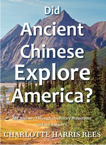
Chapter 1 – An American
Mystery
I started
the trip of the eastern slope of the US Rocky Mountains with
a few travel books. However, because of interesting new
materials gathered on the way, my backpack became very
heavy. As we checked in at the airport on our way home my
suitcase was overweight. To satisfy the airline, another
large book was moved to my backpack. However, I did not
care. I tingled with excitement because of all that we had
learned and uncovered on the trip.
It was the
day before the first Presidential Debate of 2012 which was
to be held in Denver. The long line through security at that
airport stretched on and on so Dave reached over to carry
the backpack for me. I had to chuckle when he grumbled: “You
brought along the whole Library of Congress!”
Several
weeks later I confessed to Dave that there had also been a
few small stones in the bottom of that backpack that I had
collected during my travels.
“Why?” He
asked with puzzled consternation.
“Because
they’re pretty.”
Before I
settled into my seat on the plane, I took out The
Archaeology of Colorado at which previously I had only
glanced. In my original scan of that text, it caught
my eye that Olivella shells were found in some ancient
graves in Colorado. They were thought to have come all the
way from the Gulf of California and were one of the first
trade items of Native Americans. Olivella shells look
strikingly similar to tiny cowrie shells, found in some of
the most ancient Chinese graves. The Chinese geography, the
Shan Hai Jing, even mentions cowrie shells off the
coast of what has been charted as California. I had no idea
about the exciting information ahead.
The
Archaeology of Colorado
told about an unexplained people group, who for lack of a
better name were called the McKean Complex. They visited
that area around 4000 years ago.
I was struck
with how much the McKean Complex paralleled the Chinese of
the same era. The McKean campsite structures were circular
and three meters in diameter with packed down earth floor.
Their signature was that they contained a basin shaped
hearth. They were typically built on river terraces. Some
were pit houses.
The houses
of the Chinese Yang-shao villages of that time were also
typically three to five meters in diameter and were square,
oblong, or round with plastered floors. Each house was
furnished with a gourd-shaped pit for a hearth. They were
also built on river terraces. Some were pit houses.
Archeological drawings of reconstructed Chinese houses of
that era look similar to Native American tipis.1
The McKean
people collected seeds and vegetable products, trapped small
animals, and hunted bison. In seeking quartzite, they dug
many pits up to thirty feet deep and fifty feet in diameter.2
At some sites there were mortars and pestles of stone used
for processing food. It is a mystery how the McKean people
could have been so advanced.
The
University of Manitoba stated concerning the McKean Complex:
Bone
implements that were possibly used for gaming, decorative
beads, and basket fragments suggest a complex and elaborate
cultural tradition.3
The
University of Manitoba’s map of the northern stretches of
the McKean complex showed that this culture spread in a
swath from Wyoming north through eastern Montana, western
North Dakota, through the southeastern corner of
Saskatchewan, and to the south western part of Manitoba,
Canada.
The outline
of the McKean habitation area shown on the map looked
strangely familiar. Where had I seen that layout before?
Then it dawned on me that it matched one of the journeys of
the Shan Hai Jing as charted by Mertz. One could
almost trace one map from the other.
Most likely
Mertz had no knowledge of the McKean Complex when she drew
her sketch of that journey. Most of the information for this
complex was gathered since her book was written and to my
knowledge she never mentioned McKean Complex in her
writings.
It was noted
that only one McKean burial site was found in Canada. That
would be typical of a survey group. They would have only
taken those who were young and physically fit and would not
have stayed a long time.
The journey
described in Shan Hai Jing Book 4 section 2 for which
Mertz had drawn the map similar to the one for the McKean
Complex, probably came after the journey described in
Shan Hai Jing Book 4 section 1, that my husband and I
had just followed. However, at some points those two
journeys covered the same ground.
Possibly
there were different Chinese survey groups for those two
journeys who unwittingly crossed paths. The journey similar
to the McKean Complex worked south from Manitoba, but on the
way also came close to Casper and Medicine Bow Peak in
Wyoming and Longs Peak, and the Collegiate Mountains in
Colorado. Both surveys seemed to follow the rivers and the
mountain ranges.
In Wyoming’s
Big Horn Mountains, through which Mertz charted this
journey, is now a mysterious US federally recognized
historic landmark, Big Horn Medicine Wheel, which some refer
to as the “American Stonehenge.” In the past some tried to
explain it by comparing it to an Indian medicine lodge.
However, there are several dissimilarities.
Astronomer,
Dr. John Eddy, wrote in Science Magazine:
The word
‘medicine’ was used by Indians to mean ‘magic’ or
‘supernatural’ and the Medicine Wheel is associated in most
accounts with religious use.4
Eddy
discovered that solstice and stellar alignments are
indicated by Big Horn Medicine Wheel. When he tested his
hypothesis at the summer solstice in June 1972 and again in
1973, he encountered boot deep snow both times. However,
though snow was deep at lower elevations, wind cleared the
actual circle on both of those occasions. Eddy stated that
only at the summer solstice would there have been practical
access.
Stanford
University describes it:
an
80’diameter wheel-like pattern made of stones. At the center
of the circle is a doughnut-shaped pile of stones, a cairn,
connected to the rim by 28 spoke like lines of stones. Six
more stone cairns are arranged around the circle, most large
enough to hold a sitting human. The central cairn is about
12 feet in diameter and 2 feet high.5
It may be of
great significance that Big Horn Medicine Wheel is divided
by 28 spokes, not equally spaced apart, with each spoke
going out from a hub.
According to
Needham, in the early second millennium BC Chinese divided
the night sky into 28 sections to mark the 28 days of the
lunar calendar. The spokes on those Chinese star charts were
around a hub and purposely were not equidistant.
A photo of
one of the Chinese astronomical devices can be seen in the
Genius of China.6
It is very similar to the Wyoming model.
It is not
possible to carbon date stone, but attempts to date Big Horn
Medicine Wheel by objects found nearby gave a date of around
AD 1700 – before Caucasians reached that region. However, a
problem arises concerning the possibility of Native American
construction of it. On its discovery by Caucasians no native
group could tell about its origin other than to say that
“the Sun built it” or that it had been there from “before
the light came.” The Crow Indians said it; “was made by
people who had no iron.”7
All those statements imply great antiquity.
Centuries
later people from India adopted the same lunar system with
28 spokes, but it was the Chinese who initiated it. Chinese
astronomical methods were later adopted by the world and are
used today. Using the stars Chinese were able to navigate
and then return home at early dates.
In fact,
Edward Vining in quoting Kuan-Mei reported that one
reason that Chinese first came to Fu Sang (America) was for
astronomical studies. “It is in Fu-sang that Hwang-ti’s
astronomers resided (who were charged with the observation
of the rising sun).”8
Hwang-ti mentioned here was the legendary Yellow Emperor who
preceded the earliest Chinese dynasty.
Even if
nomadic Native American tribes, not known for buildings or
monuments, did construct Big Horn Medicine Wheel, how did
they gain such complicated knowledge of astronomy which
enabled them to build a structure that charts not only the
progress of the sun but also that of at least three
different stars?
In the Big
Horn Basin in Wyoming is found some of the oldest rock art
in North America – believed to date back thousands of years.
Perhaps that should be considered in dating Big Horn
Medicine Wheel. Legend Rock, which is downstream from Big
Horn Medicine Wheel, has been linked by technique and
imagery to sites around the world including Ningxia, China.9
Similar rock art in China also dates back thousands of years
to their early dynasties.10
If per
chance the Chinese built Big Horn Medicine wheel in Wyoming
in the second millennium BC, is it possible that an
unsupported structure made of loose stones could survive all
those years?
If this were
New Mexico, in which Spaniards and others repeatedly
explored and warred starting in the early 16th
century, probably not. But in Wyoming, which the white men
did not reach until the 19th century and in a
remote location at almost 10,000 feet altitude on a mountain
covered with snow for most of the year, the possibility
exists. This is on a well worn trail, but technically very
much “off the beaten path.”
There are
other similar wheels in the area. University Regina,
Saskatchewan reports:
Boulder
monuments are patterns traced upon virgin prairie utilizing
glacial till boulders to define a desired outline pattern.
The boulders most commonly used range from 10 cm (4 inches)
to 40cm (16 inches) in diameter.….Currently 167 of these
monuments have been recorded in Saskatchewan….examples
include 11 medicine wheels, 10 ceremonial circles, four
human effigies, five animal effigies, and three geometric
designs… An additional 200 - 300 have been recorded on the
Northern Great Plains.11
The oldest
of those monuments in Saskatchewan has been tentatively
dated at 1600 years old. Northern Great Plains locations
which they listed include Montana, South Dakota, Wyoming,
Minnesota, and Iowa. Again note that these were mainly
locations on which Mertz charted Shan Hai Jing
journeys.
In
Chinese Maritime Activities and Socioeconomic Development,
c. 2100 B.C. – 1900 A.D. Dr. Gang (Kent) Deng of the
London School of Economics cites many different authors who
illustrate that Chinese had gone to sea by this early
period.
Dr.
Kwang-Chih Chang of Harvard wrote in two of his books about
peanuts (Arachis hypogaea), native to the Americas, found in
archeological sites in two different provinces in China that
dated to before 2000 BC.12
Dr. Nasir El Bassan, confirms that Arachis hypogaea is
native to tropical and subtropical South America.13
That is further indication that Chinese crossed the Pacific
at early dates.
However, the
mysteries seemingly remain. Who were those advanced McKean
Complex people? Who built the medicine wheels and when? In
the early and mid 20th century American
archeologists went to Europe to try to find answers to
mysteries about Native Americans. Still today, many will not
show the same interest in looking across the Pacific for the
solution.
Endnotes
Chapter 1
– An American Mystery
1
Kwang-Chih Chang, The Archaeology of Ancient China,
New Haven, CT: Yale University Press, 1972, pp. 97-99.
2
James Duguid and Gabriel Bedish, “An Analysis of the Spanish
Diggings Region of Wyoming During Paleolithic Inhabitation”
WyAr 11(1) 1968 Part 2 Wyoming Archaeological Society.
3
“The McKean Complex,” University of Manitoba n.d. Web 4
October 2012 <http://www.umanitoba.ca/faculties/arts/anthropology/manarchnet/chronology/archaic/mckean.html>.
4
John A. Eddy, “Astronomical Alignment of the Big Horn
Medicine Wheel,” Science, 7 June 1974, Vol. 184, No.
4141, pp. 1035 – 1043.
5
“Ancient Observatories Timeless Knowledge: Bighorn Medicine
Wheel” n.d. Web. 18 October 2012 <http://www.solar-center.stanford.edu/AO/bighorn.html>.
6
Robert Temple, The Genius of China, Rochester,
Vermont: Inner Traditions: 1986, 1998, 2007, p.37-39.
7
I.S. Bartlett, ed., History of Wyoming Vol. I,
Chicago: The S. J. Clarke Publishing Company, 1918, p. 41.
8
Edward Payson Vining, An Inglorious Columbus: Evidence
that Hwui Shan and a Party of Buddhist Monks from
Afghanistan Discovered America, London: D. Appleton and
Company, 1885, p. 221.
9
Michael FitzGerald, “Portals to Other Realities,” Wall
Street Journal, 18 September 2010 Web 8 June 2013 <http://www.online.wsj.com/artile/SB10001424052748704644404575482342261278092.html>.
10
Paola Dematte, “The Rock Art of Inner Mongolia and Ningxia”
n.d.Web 12 May 2013 <http://www.bradshawfoundation.com/china/ningxia/index.php>.
11
“Boulder Monuments” n.d. Web 19 October 2012
<http://www.esask.uregina.ca/tmc_cms/modules/customcode/includes/print_entry.cfm?entryid=7344226D-1560-95>.
12
Kwang-Chih Chang, Early Chinese Civilization:
Anthropological Perspectives, Cambridge, MA: Harvard
University Press, 1976, p. 45 and Chang, The Archeology
of Ancient China, p. 157.
13
Nasir El Bassan, Handbook of Bioenergy Crops: A Complete
Reference to Species Development and Applications,
Oxford, UK: Routledge, 2010.
I hope this sample reading has
sparked an interest my journey through the Rocky Mountains
in search of answers.
If you would like to be added to my
email list follow
this link to my
contact page and send me a quick email. When
new information concerning the topics on this site become
available, you will be one of
the first to know!
Charlotte Harris Rees