|
Zheng He’s Inheritance-
Chinese Charts of the Americas from Ming back to Xia
Speech for Library of Congress 5/16/05
ã2005
Charlotte Harris Rees - (HarrisMaps@msn.com)
In 1972 my father
Dr. Hendon M. Harris found in an antique shop in Korea a very old
map of a style he had never seen before. Father was born in
Kaifeng, China of missionary parents. He was fluent in several
classical languages. As early as he learned English he learned
Chinese and was well versed in the Chinese classics including the
Shan Hai Jing (the worlds' oldest geography). The
SHJ- written 2200 B.C. reported expeditions to the ends
of the earth including Fu Sang- a beautiful land to the
east of China.
In 1975 my father
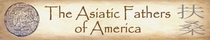
published two books in one volume of almost 800 pages titled the
Asiatic Fathers of America. Book one is "The Chinese
Discovery and Colonization of Ancient America" (2640 B.C. to 2200
B.C.). Book two is "The Asiatic Kingdoms of America" (458 A.D. to
1000 A.D.). His book contends that Chinese weren’t the only Asians
to visit the Americas at early times but our topic today is
Chinese.
Father's book and
his ideas had little acceptance before his untimely death in
1981. By that time he had seven map books and had located 23
other similar maps in museums or collections around the world. He
was convinced that these maps were descendents of the long lost
“mother map” that originally accompanied the SHJ.
In early 2003 my
brother and I brought the maps to the
Library
of Congress to validate them. After much research, I am
thoroughly convinced of my father's theories. I recently abridged
The Asiatic Fathers of America and am now writing
The Secret Maps of the Ancient World. I want to thank
Dr.
Cyclone Covey, professor emeritus of Wake Forest who has
researched, lectured, and written on this subject for over 50
years. He has been my advisor and mentor for these two writing
projects.
I. The
Harris Map (Ch’onhado) or (Tian Xia)
The type of map
Father found in the Korean map book is a Ch’onhado. The
Chinese name is Tian Xia indicating "everything under
heaven" or the whole world. The text of the map is block
print in classical Chinese which is read by both Chinese and
Koreans.
The History of
Cartography
to which I was directed in the Geography and Maps division at the
Library of Congress states that 72% of the place names on this map
are from the SHJ. (Father believed the other names
had been added with the copying over the years).
Hiroshi Nakamura
and other experts believe that this style is an old Chinese map
which though lost in China through fire or conflict was preserved
by the Koreans. “During the Ming Dynasty Koreans commonly
referred to maps of China as ch’onhado.”[1]
Though this is not a map of just China, China is obviously at the
center. Shannon Mc Cune stated “Korean cartography has had a long
history with close relations to Chinese cartography."[2]
The origin date of
this style map is unknown. An early modern commentator, Yi Ik
Seup believed it was from "time immemorial."[3]
The History of Cartography says, the map made a “silent and
utterly unnoted debut at a date we cannot pin even to the
century.”[4]
“Qing commentator Hao Yixing (1747-1825) believed there had once
been actual SHJ maps.”[5]
Nakamura was convinced “there had been a Chinese prototype of the
ch’onhado in existence already in the seventh century,
which though later lost in China, would have survived in Korea.”[6]
Many today believe
that the countries in the center of the map (China, Korea, and
Japan) are real and those on the ring continent imaginary. The
names and locations of these supposedly imaginary countries on the
ring continent are virtually identical on every map and correlate
with their location in the SHJ.
The Dr. Hendon M.
Harris collection has been validated by some leading experts.
Some of the Harris map books were serious Korean government books
with official information such as sites of water wells, military
posts, etc. Why would an imaginary map be included in such
serious books?
The Harris Map
collection consists of 7 map books. I have been told that the
oldest two are Ming dynasty - perhaps late 16th Century. Though
these would have been later than Zheng He’s voyage it is probable
that similar copies were available to him. Nakamura writes that
there is a tradition that Marco Polo took an Asian world map home
in 1295.[7]
Could it have been a copy of this same map?
There is no
mistaking the directions on these maps because they show where the
sun rises and sets. There is a frozen area in the far north. By
comparing this map to our current world map it is easy to see that
North and South America do indeed form a type of semi-circle.
Fu Sang is clearly marked where America is.
II.
Evidence of the early date of the Shan Hai Jing
The SHJ
was quoted many times throughout Chinese history. For centuries
Chinese scholars had studied this SHJ (Mountains
and Seas Classic). The story of Fu Sang has become
legendary.
“The SHJ
was one of the books on which the Chinese scholars were examined
during the time of the great examinations of China."[8]
According to
Chinese chroniclers, a copy of the SHJ was found at
the demolition of the house of Confucius [who lived 551-479 B.
C.].[9]
Tseu-hia, a
disciple of Confucius, wrote a commentary which says: "During the
reign of the Shang dynasty (1766-1122 B.C.) mention was made of a
Book of the Mountains (Shan Jing)."[10]
Chao-shi lived
during the Han dynasty. In a commentary on the Chronicles of
the Kingdoms of Wu and Yu he wrote that Y and Yu [2200 B. C.]
composed the Shan Hai King.[11]
There is mention
in Chinese writings of earlier Chinese contact with Fu Sang
but because of the SHJ we can be sure that they were
in Fu Sang by at least 2200 B.C.
III.
Evidence that the Shan Hai Jing was not just mythology
The archaic style
of the SHJ makes it difficult to understand.
Some SHJ
statements do seem mythical. It could be because the expedition
encountered people who believed in the strange beasts or we don’t
recognize some of the animals because they are now extinct.
According to K.C. Chang of Harvard the earliest Chinese works are
full of historical data but they are also full of myths and
legends.[12]
Dr. Chang stated, "In recent years as the result of
archaeological...discoveries, we have become increasingly
confident of the essential authenticity of the ancient texts, and
the historicity of the many legends."[13]
However there are
American descriptions that one could have only known by being
here.
The SHJ
describes enormous trees (which they would have encountered on
the West Coast of U.S.A.).
From the
SHJ's directions and distances of Fu Sang Henriette
Mertz in her book Pale Ink charted the routes in America.
She said that these descriptions fit no other place in the world.
The SHJ
accurately describes the Grand Canyon.
The SHJ
describes several animals native to the Americas. They include
opossum, armadillo, peccary, pronghorn, coyote, bald eagle,
elephant seal, and appaloosa horse.
IV. Further
Evidence that the Fu Sang was America and the Chinese had
been here early
Much evidence
shows us that people repeatedly crossed the Pacific and carried
things back and forth.
Tong Fan Tso (who
lived around the third century B.C.) stated that Fu Sang is
3300 miles wide and is bounded by vast oceans and has huge trees.
That is almost the exact width of America. How could someone in
China that long ago have known this?
Directions to
Fu Sang. Li-Yen a Chinese historian who lived in the Seventh
Century wrote that in order to reach Fu Sang one should
sail from the coast of the Province of Leao-Tong, north of
Beijing. From there one would travel to Japan. From there
to Wen-Shun then easterly to Da Han and from Da
Han on to Fu Sang.[14]
(Our maps show both Da Han and Fu Sang on the right
side of the ring continent. Da Han is where Alaska would
be.)
Certain plants and
animals that originated in the Americas existed in Asia long
before Columbus.
Peanuts-
native to the Americas- have been found in two different Chinese
digs dating back to 3300-2800 B.C. in Kiangsu (Jiangxu) and
Chekiang (Zhejiang) Provinces
[15]
The American
hibiscus was taken first to China and then by the Chinese to
Persia before the time of Christ.[16]
According to
George Carter there is proof that the sweet potato was
carried out of America at least three different times before
Columbus.[17]
The sweet potato from America had a very early presence in Asia.[18]
It had reached Polynesia by 800 and even had the same name there
as in America.[19]
Conversely several
items that originated in Asia were found in the Americas.
George Carter has
shown that chickens found in the Americas were Asian types.
Chicken bones in America dated to 900 A.D. are very similar to
those from southeast Asia.[20]
Even what some American Indians called chickens is almost
identical to their Chinese names.[21]
The sailing
rafts of Ecuador are of Asiatic design. The American Indian
name for these sailing rafts is derived from ancient Chinese.[22]
There were
stone bark-cloth beaters in S. East Asia before 2400 B.C.
Nearly identical beaters from the Americas date back to about 1500
B.C.[23]
Twice since 1976
Chinese stone anchors (a style unknown to the early Native
Americans but used in China 2000 years ago) were found off the
California Coast. Judging the manganese accumulation on them it
was estimated they had been on the sea bed for 2000 to 3000 years.[24]
An expert on
pyramids around the world states that the pyramids in
LaVenta are so similar to those of those of about 1100 B.C. in
China that they had to have been built by someone trained by the
Chinese of that era. Furthermore, he states that who ever built
them also brought the hookworm from Asia with them. It had
to have come by sea because hookworm only survives in warm
climates and could not have survived the trip over the Bering
Straits.[25]
China had cotton
well before 3000 B.C.[26]
Wild American cotton can’t be spun or made into cloth
unless it is crossed with old world cotton.[27]
Someone would have had to bring old world cotton seeds to America
to do that. Cotton in Peru has been carbon dated to before 2000
B.C.
The banana
has no wild relative in the new world but the banana leaf has been
frequently found in ancient Peruvian tombs.[28]
At least two
Chinese scholars independently have identified multiple Shang
era Chinese characters in the Olmec culture. At LaVenta
a list of Chinese ancestors including monarchs of the Chinese
Shang Dynasty appear on the celts.[29]
Additional proof is that the Olmec culture unexplainably sprang
fully developed about the time the Shang dynasty in China ended
about 1122 B. C. At that time up to 1/4 million Chinese fled to
sea and were never heard of in China again as they fled the
political upheaval.[30]
Native languages
of the Americas contain many Chinese words.[31]
Recent digs in
Peru show cities and civilizations sprang at 3000 B.C.[32]
Domesticated plants recovered there included cotton. Irrigation
systems are reminiscent of China. Some cities in Peru still bear
Chinese names that were being used before Europeans
arrived.[33]
V. How was
this trip possible as early as 2200 B.C.?
1. There are
wonderful rivers in the oceans. In the Atlantic it is the Gulf
Stream. In the Pacific it is called the Japan or Kamchatka
Current which goes in the same clockwise direction as the Gulf
Stream. Some authors describe the Japan Current as a conveyor
belt.[34]
Perhaps it can be better understood as a riptide. It will carry
against the wind so a boat doesn’t even need to be large or have a
sail. Once in the current a navigator has to deliberately exit the
current or will end up in America.
2. Early Chinese
had fine ships
The oldest
preserved vessel in the world (dated 2700 B.C.) is in Egypt. It
is 146 1/2 feet long and is a sea-going style.[35]
Is it not possible that early Chinese could have been just as
advanced?
Chinese
traditions indicate that they had seaworthy ships from as early as
2500 B.C.
Chinese had
a compass very early.
Ling Shun-Sheng
proved in 1956 that even bamboo sailboats could navigate the
ocean.
[36]
By 412 A.D. Fa
Hein’s ship could take 200 passengers plus 200 crew.
Young Su of Sui
dynasty (581-617) built ships with five decks. They could carry
800.[37]
We know of the
progression of ships to the grand size that Zheng He commanded.
What were all those ships doing? They were not sitting in the
harbors. We believe there is much evidence that many crossings
were made at different times.
VI Return to
look at the Harris map and consider the West side of it
I have been
discussing the early trip to the West Coast of America
but this
same map may show that both coasts of the Americas were discovered
at that early time. Four parties were sent out to the ends of the
earth in the four directions for a period of years. It was their
compiled reports that comprise the SHJ. We know
that they reached Africa because the SHJ mentions
hippopotamus and other African animals. Let us take another look
at the map. Africa shown on the Harris map is very similar to the
Africa shown on the
Kangnido. Also, in the area that we designate
Africa is Black Grandson land.
If the right side
of the Harris map is the west coast of the Americas, what is the
left side of the map? Could it be the east coast of the
Americas?
Again, was this
possible at that early date? Just last year a lone sailor in a
sailboat circumnavigated the globe. This trip around the world
has also been done in a dugout canoe.[38]
As you will see
later, some locations on the Map of the Southeast Maritime
Countries correlate with those shown on the Harris collection. If
the Chinese knew about the whole world at that early date would
not Zheng He have been privy to this information? These maps were
Zheng He’s inheritance-showing him the way.

[1]
Gari Ledyard, “Cartography in Korea, Japan, and Vietnam,”
The History of Cartography, Vol 2, Bk 2
p.262, 267
[2]
Shannon McCune, Imago Mundi 1978 Volume 4, p. 112
[7]
Hiroshi Nakamura, East Asia in Old Maps, Center for
East Asian Cultural Studies, Tokyo, 1964, p. 11
[8]
Henriette Mertz, Pale Ink, p. 18
[9]
Edward Vining, An Inglorious Columbus, London, 1885, p.
672 quoted by Hendon Harris, The Asiatic Fathers of
America, Taipei, 1975, Bk 1, p. 97
[10]
M. Bazin, Journal Asiatique, 1839 quoted in Harris,
Bk. 1, p. 97
[11]
M. Bazin on authority of Vining p. 673 quoted in Harris in
Bk. 1, p. 99
[12]
K.C. Chang, Art, Myth, and Ritual, Harvard University
Press, Cambridge, Massachusetts, 1983, p. 5
[14]
Hendon M. Harris, The Asiatic Fathers of America,
Taipei, 1975, Bk. 2, p.248
[15]
Stephen C. Jett, "Precolumbian Transoceanic Contacts," The
Diffusion Issue, Stonehenge Viewpoint, 1991, p. 26
[16]
George Carter, “The George Carter Letters,” The Diffusion
Issue, Stonehenge Viewpoint, 1991, p. 15
[18]
Cyclone Covey, A Critical Reprise of Aboriginal American
History, 6th Edition, 2005, p. 203
[19]
George Carter, “The Diffusion Controversy,” Across Before
Columbus, New England Antiquities Research Association,
Edgecomb, ME, 1998, p. 4
[20]
Carter, The Diffusion Issue, p. 15
[21]
Robert Schoch, Voyages of the Pyramid Builders,
Putnam, New York, 2003, p. 142
[24]
Wang Yung, “S. F. Sunday Examiner and Chronicle,” November 25,
1979 quoted in The Chinese of Mendocino Coast, Vol XV,
Spring 1990, p.4
[27]
Thor Heyerdahl, “Isolationist or Diffusonist,” The Quest
for America, Pall Mall Press, London, 1971, p. 133-135
[28]
Heyerdahl, p. 135- 136
[29]
Mike Xu, Origin of the Olmec Civilization, U. of
Central Oklahoma Press, Edmond, OK, 1996, p. 17
[31]
Harris, Book 2. p. 241-246
[32]
Jonathan Haas et al, “Dating the Late Archaic Occupation of
the Norte Chico region in Peru,” Nature Vol. 432, Dec.
23, 2004, p. 1020 -1023
[33]
Harris, Book 2, p. 402
[37]
Harris, Book 1, p. 269.
[38]
George Carter, “Did China Discover America Before Columbus?”
Review Magazine, April 1979,
p. 76
|